dmv.community is one of the many independent Mastodon servers you can use to participate in the fediverse.
A small regional Mastodon instance for those in the DC, Maryland, and Virginia areas. Local news, commentary, and conversation.

Administered by:

Server stats:

172
active users

#FOSS4G

4 posts4 participants0 posts today
Replied in thread

@calli #OpenSource #GIS software actually IS commercial GIS too ! You mean competitors to proprietary solutions maybe ?

At @oslandia we made numerous migrations from proprietary GIS softwares to OpenSource, in production-ready environments. Get in touch if you want more info.

Some use cases are also showcased on QGIS website ( qgis.org/project/case-studies/ ), and #FOSS4G conferences as well as QGIS conferences ( or @JourneesQgis ) are full of feedback from users migrating !

www.qgis.orgCase Studies · QGIS Web Site

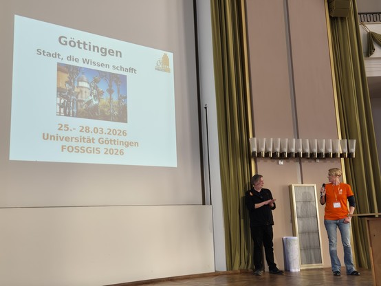
hey there's #FOSS4G2025 news!

Call for papers is open: 2025.foss4g.org/attend/call-fo

Travel grant program is open:
2025.foss4g.org/attend/travel-

You can register to attend:
2025.foss4g.org/attend/registe

Voting on a logo is open! Proposals and voting link here: wiki.osgeo.org/wiki/FOSS4G_202)

Go propose talks/register/apply for travel grants/vote for a logo!

Swing by Australia on the way and come climbing ;)

(ping @osgeo and followers)

2025.foss4g.orgFOSS4G 2025 AucklandFOSS4G 2025 Conference in Auckland, New Zealand from 17-23 November 2025

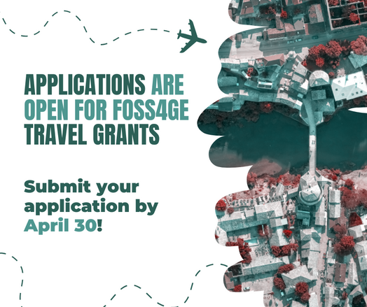
✈️FOSS4GE 2025 Travel Grants – applications open!

We’re excited to announce that the Travel Grant Programme (TGP) for FOSS4G Europe 2025 is now accepting applications! 🎉

Are you passionate about open-source geospatial technologies? Do you want to join the FOSS4G community in Mostar this July? The TGP is here to help!📝

❗Submit your application by April 30 at 2025.europe.foss4g.org/registr
#FOSS4GE #FOSS4G #mostar #osgeo

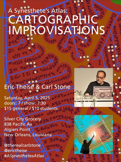
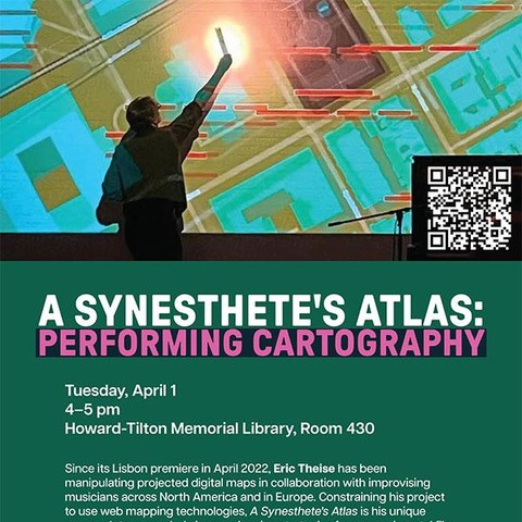
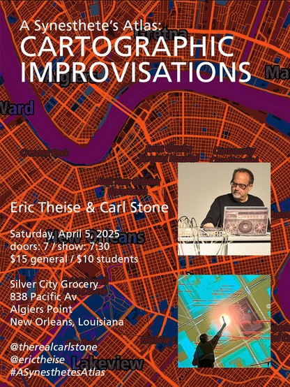
I've been to New Orleans many times in my life but not since Hurricane Katrina. Remedying that by kicking off my next tour with an April Fool's Day lecture at Tulane's Howard-Tilton Memorial Library & an Apr 5th performance w/laptopist Carl Stone at Silver City Grocery in Algiers Point.

Carl opens the evening with a solo set; the collaboration follows.

RSVP: tulane.libcal.com/event/143892

Tickets: eventbrite.com/e/a-synesthetes

#ASynesthetesAtlas #CarlStone
#maps #cartography @openstreetmap #FOSS4G

Replied in thread

Seriously - free #strategic advice for every government: Do not build infrastructure on systems over which you have no control.

"but we have a contract"

Cool cool are you able to change business decisions within the contracted party? Probably no. You have a risk you simply cannot control or mitigate.

This is why #FOSS should be at the heart of all national digital infrastructures.

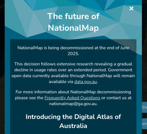
TIL... 🙄. nationalmap.gov.au is/was an open source TerriaJS instance delivering all kinds of data via open standards in a single space.

The digital atlas of Australia is based on proprietary ESRI services. Colour me disappointed, not surprised

The strategic question being: why develop a new digital atlas if the old one was not used? 🤔

Personally I would have chosen to keep developing an open platform, especially in current geopolitical light.

**geometa** provides an essential object-oriented data model in R, enabling users to efficiently manage geographic metadata.

The package facilitates handling of ISO and OGC standard geographic metadata and their dissemination on the web.

In this interview, we speak with **Emmanuel Blondel**, the author of geometa, ows4R, geosapi, geonapi and geoflow—key R packages for geospatial data management.

r-consortium.org/posts/explori

@qgis + #DroneDB #microtootorial

You have some drone images over a transect and want to get the approximate area covered [1]

Use #DroneDB CLI (docs.dronedb.app/docs/cli) to generate image footprints:

ddb info ./jpg/*.JPG -f geojson --geometry polygon -o footprints.geojson

Drop the footprint geojson into QGIS [2]. Dissolve them (Vector -> Geoprocessing Tools -> Dissolve) [3].

Reproject the result to a CRS in metres (eg UTM) and label with $area [4]

Done!

If I wanted to persuade someone who only knows ArcGIS/ESRI products that they should look at QGIS/open-source tools, what particular features should I point to? Aside from being free and open-source - what wow features do they have? What can you do easily that you can't in Arc?

(I don't really know what Arc/ESRI is like these days as I haven't used it for over a decade)

#gis#gischat#foss4g

WE ARE EXCITED TO LAUNCH THE LEARN QGIS WITH BNHR SITE!

A free learning platform that includes the most recent versions of our Essentials and Layers & Expressions courses.

We're grateful for everyone's continued support and wanted to give back in some small way.

Thank you so much and I hope this helps you in your QGIS journey!

Start learning QGIS for free at: learn-qgis.bnhr.xyz

🚀𝗚𝗥𝗔𝗦𝗦 𝗚𝗜𝗦 𝟴.𝟰.𝟭 𝗶𝘀 𝗛𝗲𝗿𝗲!🚀

We're thrilled to announce the release of GRASS GIS 8.4.1. This release brings crucial fixes and improvements to our tools, libraries, and GUI, ensuring a more stable and robust experience.

🔗 Visit grass.osgeo.org/news/2025_03_0 to learn more!

💻 Download the latest version: grass.osgeo.org/download/

Thanks to all contributors and financial supporters! 🙌

#OSGeo #foss4g #GRASS #OpenSource #GeospatialInnovation
grass.osgeo.org/download/

grass.osgeo.orgGRASS GIS - Bringing advanced geospatial technologies to the worldGRASS GIS is a powerful engine for raster, vector, and geospatial processing, enabling advanced modeling, data management, imagery processing, and time series analysis with a Python API, optimized for large-scale analysis.